


Description


🌋 Hiking Tour Lanzarote & La Graciosa – Trekking Across Volcanoes and Coastal Trails
Experience the beauty of two of the most fascinating islands in the Canary Archipelago. This hiking tour takes you from the quiet, almost timeless island of La Graciosa to the spectacular volcanic landscapes of Lanzarote.
🌴 La Graciosa – Silence and Sand
Your adventure begins with a short ferry ride to La Graciosa, the smallest inhabited island in the Canary Islands. Here, there are no paved roads—only sandy paths, tranquility, and pristine nature. Explore the island on foot along deserted bays, volcanic hills, and the crystal-clear waters of the Atlantic Ocean. A perfect, peaceful start to your journey.
🌄 From Orzola to Southern Lanzarote
Back on Lanzarote’s main island, your multi-day trek begins. From the north, hike through the lush Haría Valley, also known as the “Valley of a Thousand Palms.” Here, Lanzarote feels almost tropical, with fertile soil and surprisingly lush vegetation.
Next, climb ancient trails to the viewpoint above the rugged west coast and descend to Famara, a surfer’s village set along an endless sandy beach.
🌋 The Heart of Lanzarote – Lava Fields and Volcanoes
Continue inland, crossing vast lava fields, quiet villages, and dusty paths with breathtaking views. You’ll reach the world-famous wine region of La Geria, where vineyards thrive in black volcanic soil—an unparalleled landscape found nowhere else on earth.
On clear days, you can see the fiery silhouettes of the mountains in Timanfaya National Park, where the earth still radiates heat from ancient eruptions. While you won’t hike inside the protected park, you’ll walk along its rugged edges, feeling the grandeur of this unique volcanic terrain.
🏖️ Final Stop: Playa Blanca
Descend to the southern tip of the island and arrive at lively Playa Blanca. Time to enjoy a cold drink by the sea, feel the sand between your toes, and reflect on a remarkable journey full of contrasts.
- Explore pristine sandy paths and quiet bays on La Graciosa
- Hike through the lush Haría Valley, known as the “Valley of a Thousand Palms”
- Trek ancient volcanic trails along Lanzarote’s rugged west coast
- Discover the unique black volcanic vineyards of La Geria
- Experience breathtaking views of Timanfaya National Park’s volcanic landscape
- Relax and unwind in the vibrant coastal town of Playa Blanca


1| Arrival in Lanzarote
Upon arrival in Lanzarote, a taxi transfer will be waiting to take you to Órzola.
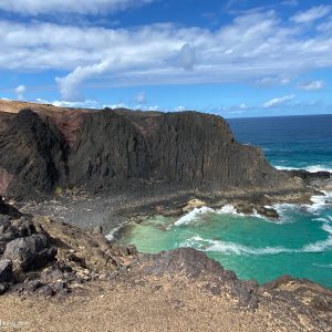
2 | La Graciosa
The journey begins with a short ferry ride from Órzola, Lanzarote, to the island of La Graciosa, approximately 30 minutes. Once you arrive in Caleta de Sebo, the main village, you start your circular hike around the island. Follow sandy paths along beautiful, secluded beaches like Playa de las Conchas, known for its clear blue waters and peaceful atmosphere. The route takes you through desert-like landscapes with wide views over the Atlantic Ocean. You can also climb Montaña Bermeja for panoramic vistas. The hike ends back in Caleta de Sebo, a perfect spot to enjoy a terrace before the ferry picks you up.
Distance options: 11 km, 20 km, or 11.5 km
Elevation gain/loss: +130 m / –130 m, +190 m / –190 m, or +170 m / –170 m depending on chosen route
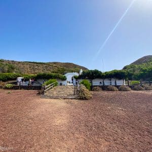
3 | Órzola to Haría
The hike from Órzola to Haría is a beautiful route through northern Lanzarote. Starting in the picturesque fishing village of Órzola, you walk along the coast with views of the ocean and nearby La Graciosa. The trail leads you through rugged inland terrain, with the Corona volcano always in sight. Along the way, pass traditional Canarian houses and agricultural fields. The route ends in Haría, a village surrounded by green valleys and palm trees.
Distance: 16 km (approx. 4.5 hours)
Elevation gain/loss: +1470m / –190 m
4 | Haría to Famara
The trek from Haría to Famara takes you through the wild northern landscape. Begin in Haría, famous for its palm trees. The trail gradually climbs to Bosquecillo, a small forest on the plateau with stunning views over the west coast and the Atlantic Ocean. Then descend along the impressive Famaraklif, a steep cliff hundreds of meters high, offering spectacular views of Famara beach. The hike finishes in the quiet village of Famara, popular with surfers.
Distance: 11 km (approx. 3.75 hours)
Elevation gain/loss: +370 m / –640 m
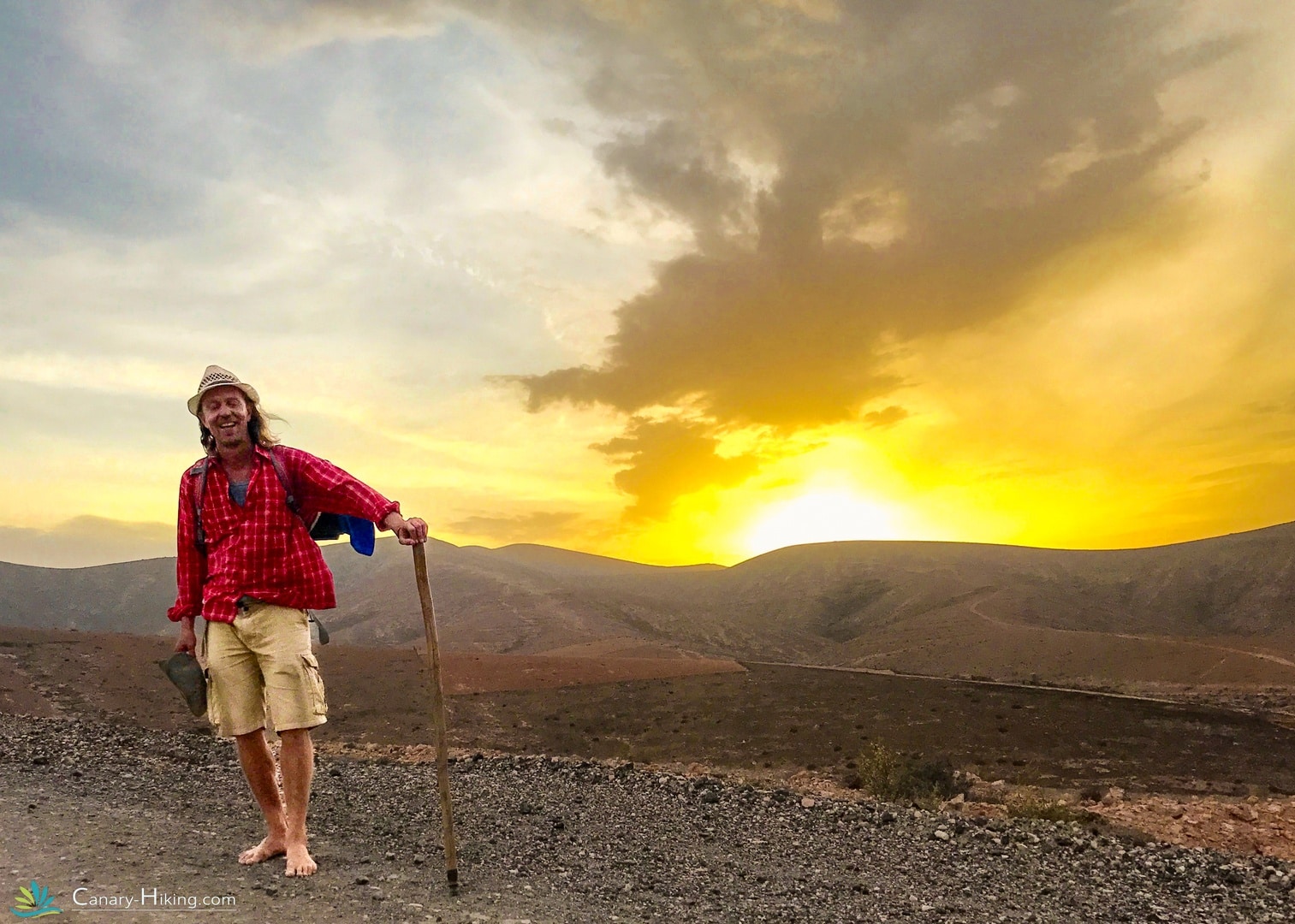
5 | Famara to Tinajo
Starting from the long, expansive Famara beach, this hike follows an ascending path through volcanic landscapes. Pass ancient pathways and traditional agricultural terraces typical of the area. Enjoy breathtaking views of the Atlantic Ocean and Lanzarote’s interior. The route passes abandoned farms before arriving in Tinajo, close to the volcanic Timanfaya National Park.
Distance: 17 km (approx. 4.5 hours)
Elevation gain/loss: +250 m / –60 m
6| Tinajo to Yaiza
The walk from Tinajo to Yaiza takes you through the unique wine region of La Geria, famous for its distinct viticulture technique. Here, grapevines are protected by semicircular stone walls built in small pits to retain moisture in the dry volcanic soil. The view over the lava-stone-surrounded vineyards is spectacular. The trail offers views of the Timanfaya volcanoes and ends in the village of Yaiza.
Distance: 25 km (approx. 7 hours)
Elevation gain/loss: +460 m / –480 m
7 | Yaiza to Playa Blanca
Following the GR131 trail, this hike from Yaiza to Playa Blanca passes through the volcanic landscape of southern Lanzarote. Depart from the traditional village of Yaiza and follow well-marked paths through the enchanting Timanfaya National Park, walking alongside hardened lava flows and black volcanic craters. The terrain is rugged with sparse vegetation. As you approach Playa Blanca, the landscape opens up with views of the coast and nearby islands Fuerteventura and Los Lobos. The hike ends in Playa Blanca, a lively seaside resort.
Distance: 16 km (approx. 4.5 hours)
Elevation gain/loss: +100 m / –270 m
8 | Departure to Airport
End of your Lanzarote and La Graciosa tour. Transfer to the airport for your departure.
Inclusive
- Travel duration 8 days
- Transfer to Orzola from airport
- Transfer to Lanzarote airport
- 7 nights Lanzarote mostly with breakfast
- Return ferry Lanzarote | La Graciosa
- Hiking routes and descriptions
- Script
- STO Garant
- Whatsapp support
Exclusive
- Return trip
- Travel and cancellation insurance
- All meals and drinks except breakfast
- Booking fee €25.00
- Transfers outside the program
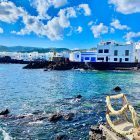
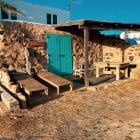
Een greep uit onze accommodaties op Lanzarote


Frequently Asked Questions Lanzarote & La graciosa
Who is this walking tour suitable for?
This trip is suitable for active hikers who love nature, peace and adventure. You don’t have to be a mountain goat, but a good basic condition is important. The paths are varied: from easy to challenging, sometimes with loose stones or short climbs.
How difficult is this hike?
The difficulty level is easy/medium. Most stages are 12–20 km long with slight elevation changes. Due to the dry climate and little shade, the heat can be extra tiring. It is important to be well prepared (sufficient water, sun protection).
Do I have to carry my own luggage?
No, your luggage is transported for you. You walk with a light daypack, in which you carry your water, snacks, sunscreen and personal items.
Can I do this trip solo?
Yes! This walking tour is perfectly doable as a solo traveler. The route is well described, you get support along the way, and many travelers even find it extra special to walk alone through this unique landscape.
What do I take in my daypack?
Recommended:
- 1.5 to 2 litres of water
- Hat/cap and sunscreen
- Snacks (e.g. nuts, fruit, energy bar)
- Hiking map or phone with GPS
- Possibly a light windbreaker or fleece
Where do I stay during the tour?
You will stay in small-scale, local guesthouses, fincas or casa rurales, with a personal atmosphere. Some are located in quiet places inland, others in lively villages. Once in Playa Blanca you will stay in a larger hotel with a swimming pool.
What is the best time to travel?
The best periods are October to May. In these months the walking weather is most pleasant: warm during the day (18–25°C), cooler in the evening. In the summer months it can get very hot.