Description
In collaboration with Trailrun Europe,
we organize both individual Trailrunning trips and Trailrun trips in groups.
Do you want to prepare for a trail run competition and altitude training? Do you want to spend the night in unique small-scale accommodations selected by us? And do you want to train in wonderful temperatures? Then the Canary Islands are the ultimate islands for you.
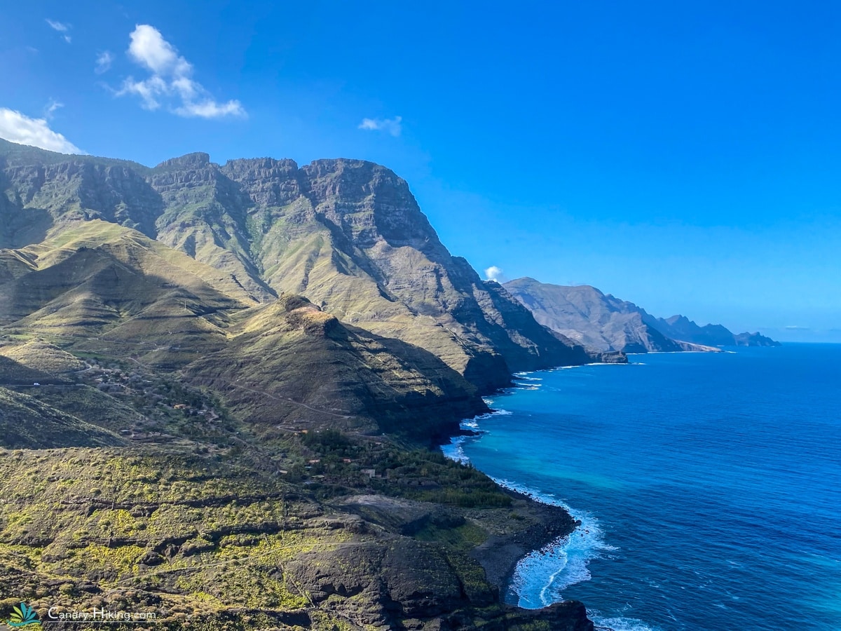
The whimsical Gran Canaria has it all. Perfect for your altitude training, it offers beautiful scenery of mountains, canyons and scenic trails that are perfect for trail runners. Gran Canaria has a mild climate all year round, but the summer months can be very hot, especially inland. The best season for trail running is autumn, winter and spring when temperatures are more pleasant. The daily distances are between 16 and 30 km per day. And you have 5 or 6 trail days.

Inclusive
- Travel time: 8 days
- 6 organized Trail days
- Transfer airport to Accommodation
- Trail ride in groups over 175 km
- Places for breaks with food and drink options
- Nice Hotels with breakfast
- Broom wagon
- Canary Hiking Buff and stainless steel drinking bottle (Goodiebag)
- Travel guarantee STO
- Luggage transport
Exclusive
- Outward and return journey
- Travel and cancellation insurance
- All meals and drinks except breakfast
- Booking costs €20.00
- Possible single room supplement € 295.00
- Transfers outside the program
1| Arrival in Las Palmas
Upon arrival at the airport, you will be transferred to your accommodation in Agaete. Agaete is a nice place where you can enjoy a delicious meal. A pleasant place with a church square and some bars. Close to Agaete is Puerto de Las Nieves. Las Nieves is very nice, with a rough coastline and many restaurants. The high cliffs at the harbor reminded us of Norway. Authentic restaurant to eat is: Restaurante Dedo De Dios.
Our accommodation has a delicious breakfast! There is a supermarket if you want to bring food and drinks for the next day.
2| Short trail in Agaete (Circular)
The valley of Agaete is known for its spectacular landscapes and fertile soil. The area is dotted with terraced farmland, where traditional crops such as coffee, fruit trees and vines are grown. To get used to the climate, a short vibrating route is on the program today.
Distance: 14 km
Height difference: +824 up / -824 down
3| Depart Puerto de las Nieves to Cruz de Tejeda
The trail run path from Agaete to Cruz de Tejeda is a challenging adventure tour. The trail offers beautiful scenery and some of the most breathtaking parts of Gran Canaria. The trail path to Cruz de Tejeda follows an approximately 17-mile track through the mountains. You will follow a winding route through the valleys and mountain trails until you arrive at the property. The route from Agaete to Cruz de Tejeda falls under the spicy category. There are breaks along the way where we offer water, fruit and a small snack.
Distance: 27 km
Elevation difference: +2298 up / -795 down
4| Cruz de Tejeda Vega san Mateo (Circular)
This route is a beautiful challenging route for trail runners. It offers a mix of spectacular scenery and technical trails. From the small village of Cruz de Tejeda you can enjoy the panoramic views of the mountains and valleys. We trail around Roque Nuble, the imposing rock formation that rises above the landscape. There will be some steep climbs, so be prepared for the challenging terrain. Vega San Mateo is a charming village surrounded by green hills. We have a stop here where you can taste the local delicacies.
* In the winter months it can be very cloudy in the northern part of Gran Canaria. Prepare well for layers of clothing. The cloud cover often clears up once you go over the top. Always check the weather forecast before you go.
Distance: 25 km
Altitude difference: +1493 up / -1493 down
5| Cruz de Tejeda to Mogan
This route is a wonderfully challenging route popular among trail runners due to the spectacular scenery and elevation change that you can experience during your trail. After passing through the Pilancones Natural Park, the descent will begin to Mogan. This descent can be quite challenging, watch your technique and bring your poles. Because this route is very long, we divide it into 2 days.
Distance: 25 km
Altitude difference: +1191 up / -2477 down
6| Departure from Mogan to Puerto Mogan
The journey from Tunte to Ayagaures is another long journey with climbs and descents. At some point you pass a broken piece of mountain where the path has sunk and you have to find your way down along a rope. Ayagaures is a small town with a gigantic reservoir. A village where there is actually nothing to do. Besides a restaurant: La Cueva de Ayagaures. This restaurant is really nice and tasty restaurant. Enjoy your last ‘quiet’ evening here before you enter touristic Maspalomas. Habitat Arte is small-scale and the only accommodation in this village. This includes breakfast! There is no supermarket in Ayaguares!
Distance: 22 km
Height difference: +635 up / -1135 down
7| Puerto Mogan
Free day with option an extra trail day, without guidance (Circular)
From Puerto de Mogan follow the path north towards Mogan. The terrain gets rougher as you head towards los Pastores. There are beautiful views along the way including the coastline of Gran Canaria
Distance: 17 km
Height difference: +601 up / -588 down
8| Departure to Airport
Information about the return journey
If you have booked an 8-day trip, you will be dropped off at the airport. If you want to stay a few extra days, that is also possible. We help you with this.
Because we like that you are coming with us, we will give you a Goodiebag as a gift!


Our special accommodations


Distance
176 km
Difficulty
Average/Hard
Up. D+
6441 m.
Down. D-
7024 m.

Can I help you?
Non-binding and personal. I would like to help you further, via e-mail, telephone or whatsapp button on the site. We are available 7 days a week. During the weekend it can take a few hours before you can get a response from me.


