

Description
Difficulty level


Trail Running along the GR131 from Agaete to Maspalomas
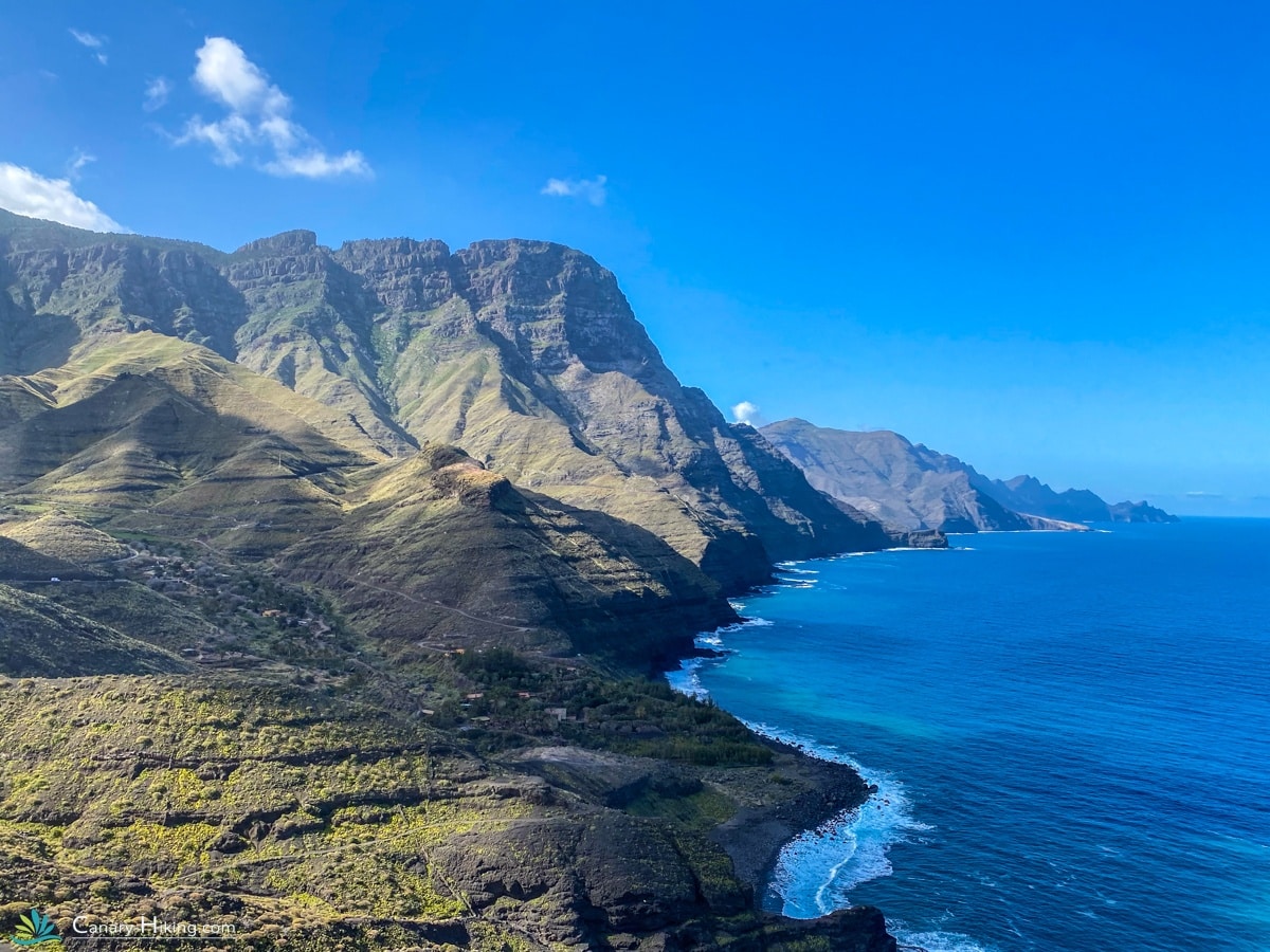
The Light Trail Run Gran Canaria is an 8-day individual trail running trip for active hikers and trail runners who want to discover the GR131 across Gran Canaria without choosing the most demanding option. Over five trail running days, you run from the north to the south of the island, from Agaete via Artenara, Tejeda and Ayagaures to Maspalomas. The route takes you along mountain trails, through the Tamadaba nature area, past spectacular viewpoints and through the rugged interior of Gran Canaria. The stages are challenging due to the elevation changes, but are deliberately shorter than those of the Heavy Trail Run. This gives you more time along the way to enjoy the villages and accommodations. The trip ends in Maspalomas, where you have an additional free day after the final trail running stage to relax by the sea or at the pool.
What makes this Trail Run special?
✅ GR131 Gran Canaria: trail run from the north to the south of the island.
✅ Five trail running days: challenging stages with time for recovery and relaxation.
✅ Tamadaba: trail run through one of the most impressive mountain areas of Gran Canaria.
✅ Tejeda: stay in one of the most beautiful mountain villages on the island.
✅ Elevation changes: train in the mountains of Gran Canaria with regular significant ascents and descents.
✅ Less demanding than the Heavy Trail Run: shorter stages make this option more accessible to trail runners looking for a challenge without choosing the maximum distances.
Activity Level
This trip is suitable for sporty trail runners with a good level of fitness and experience in trail running on mountainous terrain. The routes range from 15 to 25 kilometres and include significant elevation changes. The first stage from Agaete is particularly demanding because of the steep climb towards the Tamadaba area. The routes are provided with GPX files, allowing you to trail run independently.
Included in this trail running trip
✓ 8-day individual trail running trip
✓ 5 trail running stages
✓ Overnight stays in carefully selected, small-scale accommodations
✓ Luggage transfers between accommodations
✓ All necessary passenger transfers during the trip
✓ GPX files for all trail running routes
✓ Detailed Canary-Hiking travel itinerary with practical information
✓ Access to the Canary-Hiking Travel App with daily programmes, routes, GPX files and accommodation details
✓ 1 month of free use of the Canary-Hiking Komoot App from the start of your trip
- Prices are based on 2 persons
- Trail paths along special views
- Part of the GR131
- Beautifully rugged interior
- Reservoirs
- Special overnight stays
- Roque Nuble & Tejeda
- Extra Trail Day(s)
- Extra night in Maspalomas

1| Arrival in Las Palmas
Upon arrival at the airport you will be taken to your accommodation in Agaete. Agaete is a nice town where you can enjoy delicious food. A friendly place with a church square and some bars. Puerto de Las Nieves is located close to Agaete. Las Nieves is very nice, with a rough coastline and many restaurants. The high cliffs at the harbor reminded us of Norway. Authentic restaurant to eat is: Restaurante Dedo De Dios.
2| Puerto de las Nieves to Artenara
The trail running path from Agaete to Artenara is a challenging adventure tour. The trail offers beautiful landscapes and some of the most breathtaking parts of Gran Canaria. The trail path to Artena follows an approximately 23 kilometer long route through the mountains. You follow a winding route through valleys and mountain paths until you arrive in Artenara. The route from Agaete to Artenara falls under the spicy category. The first part of the path in particular goes up steeply. Keep in mind that you mainly walk up this part. After about 9 km you have arrived in the Tamadaba nature reserve and the route will run up and down towards Artenara. If you think this tour is too tough, we will send you an alternative that has slightly fewer elevation meters. The route through Tamadaba is 25 km with 2020 meters of elevation gain. The alternative route to El Hornillo is 19 km with an elevation gain of 1500 meters.
Distance: 25km/19km
Elevation difference: +2240 or +1900 up / –810 or 300 down
3| Artenara to Tejeda
The trail from Artenara to Tejeda is a beautiful route in Gran Canaria. It is a popular trail for trail runners because of its breathtaking landscapes and challenging terrain. The total distance from Artenara to San Bartolomé via Tejeda is approximately 16 kilometers with over 1000 meters of elevation gain. Because Tejeda is a very nice town, we have not made this trail day too long so that you have more time for this nice town.
Your route starts in Artenara, a picturesque village known for its beautiful views of the mountains and ravines. From Artenara you follow your trail towards Tejeda with your GPX file. Along the way you will pass steep slopes, gorges and spectacular viewpoints.
Once in Tejeda you can enjoy the nice village, known for its traditional architecture and the beautiful view of the Roque Nublo, an iconic rock formation in the center of the island.
Distance: 16 km
Elevation difference: +1080 up / – 1250 down
4| Tejeda to San Bartolomé
Today’s trail route promises a beautiful and challenging tour in Gran Canaria. With more than 800 meters of elevation ahead of you, you climb the road to Cruz de Tejeda from Tejeda. This tour is often called the most beautiful: you may see grazing sheep everywhere, absolute silence, and spectacular views.
Once at the top, the descent to San Bartolomé de Tirajana begins, where you descend from 1700 to 900 meters. You will spend the night in a Casa Rural in the heart of Tunte, a charming village.
Distance: 22.7 km
Elevation difference: +880 up / – 1040 down
5| San Bartolomé de Tirajana to Ayagaures
The trip from Tunte to Ayagaures is again a beautiful, not too long trip with climbs and descents. From San Bartolomé you cross to reach the Barranco de Ayagaures. Ayagaures is a picturesque little town with a gigantic reservoir. A village where there is actually nothing to do. Except for a restaurant: La Cueva de Ayagaures. This restaurant is a nice and tasty restaurant. You will stay in a small-scale accommodation. This includes breakfast! There is no supermarket in Ayaguares!
Distance: 15 km
Elevation difference: +300 up / – 930 down
6| Ayagaures to Maspalomas
Trail running from Ayagaures to Maspalomas is a beautiful last trail route in Gran Canaria. It offers a great mix of natural beauty and challenging terrain for runners who love adventure. The trail run starts at the Ayagaures Dam, located in the ravine of the same name. This is a popular spot for walkers and runners.
Via the ravine, this path leads you through a beautiful landscape of green valleys, rock formations and narrow paths. The terrain can be challenging at times, so be careful and take your time to enjoy the views. The path becomes slightly flatter and you pass dry riverbeds and palm forests. After about 15 kilometers you will finally reach Maspalomas, a popular seaside resort on the south coast of Gran Canaria. Here you can enjoy the beautiful sand dunes and relax on the beach after your trail run.
Distance: 19 km
Elevation difference: +180 up / – 490 down
7 | Extra day off in Maspalomas
Relax by the sea or by the pool.
8| Departure
You will be picked up by our transfer service and dropped off at the airport.
Information about the return journey
If you have booked an 8-day trip, you will be dropped off at the airport. If you want to stay a few extra days, that is also possible. We will help you with this.
Inclusive
- Travel duration: 8 days
- Return Transfer Airport
- Luggage transport
- Individual trail tour over 100 km
- Nice Casa Rurales private room and bathroom
- All accommodations have a private bathroom and bedroom
- Some accommodations with breakfast
- WhatsApp support during the trip
- STO travel guarantee
- Acces to our travel app
Exclusive
- There and back journey
- Travel and cancellation insurance
- All meals and drinks other than breakfast
- Booking costs
- Possible single room supplement
- Transfers outside the program
- Luggage transport surcharge for those traveling alone
Our special accommodations


Distance
100 km
Difficultly
Average
Up
4680 m.
Down
4520 m.

Can I help you further?
Non-binding and personal. I would like to help you further, via email, telephone or WhatsApp button on the site. We are available 7 days a week. On weekends it may take a few hours before you can receive a response from me.