


Description
Niveau

GR131 Trekking on Gran Canaria – A Surprising Hiking Journey Through the Heart of the Island
The GR131 on Gran Canaria is a trail made for true explorers. This long-distance hike spans roughly 85 kilometers, divided into five scenic stages, stretching from the quiet, green northwest to the dry, rugged south of the island. Although Gran Canaria wasn’t originally part of the GR131, the route is now fully waymarked – and it’s become a stunning addition to the network of long-distance trails across the Canary Islands.
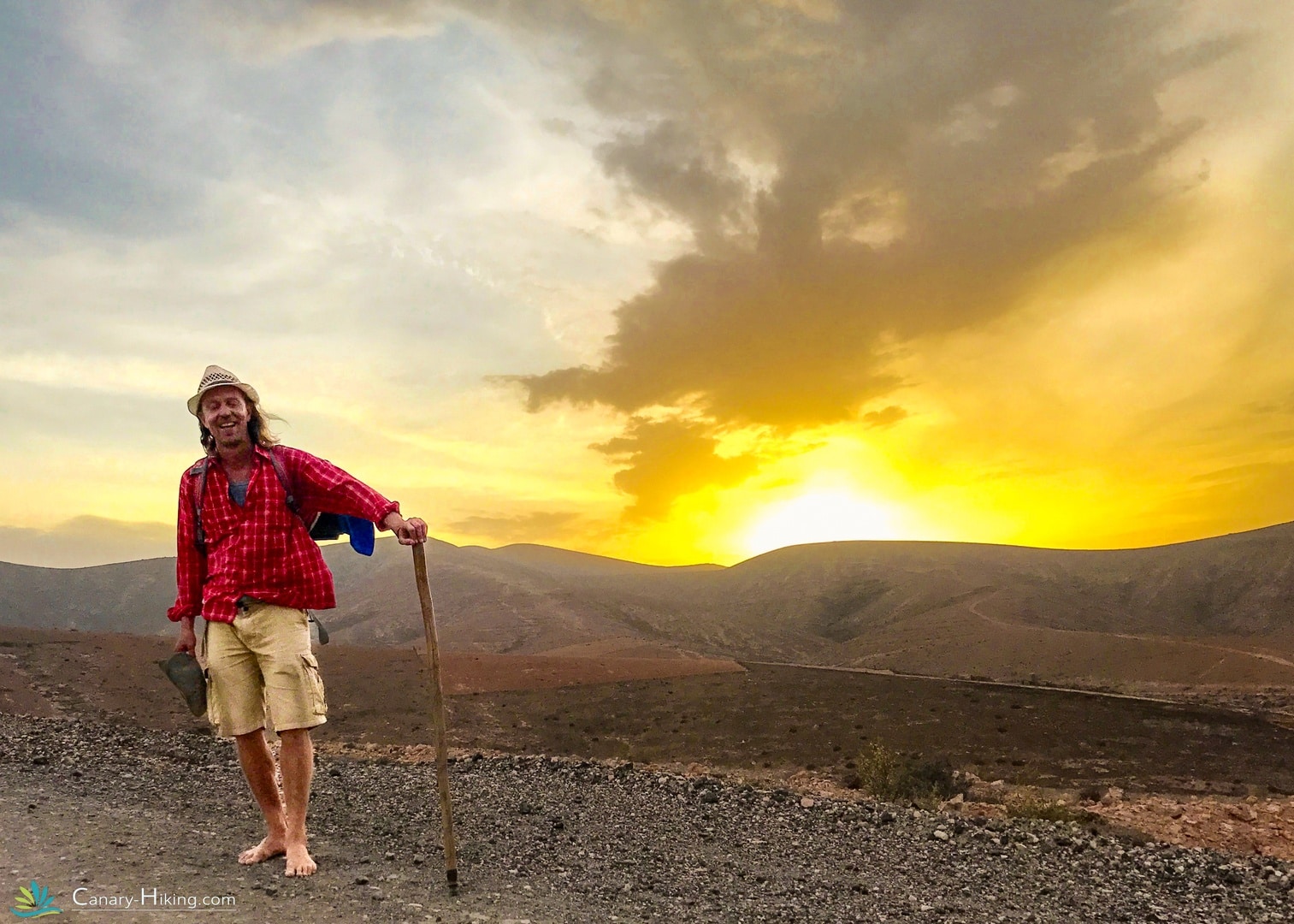
Over the course of this trek, you’ll hike an average of 15 kilometers per day, mostly on unpaved mountain trails, through deep ravines, dramatic landscapes, and hidden valleys. With more than 1,700 meters of elevation gain, a good hiking condition is essential. But the reward? Breathtaking views, untouched nature, pure silence, and a deeper connection with the real soul of Gran Canaria – far from mass tourism.
✨ Why hike the GR131 on Gran Canaria?
🌲 Tamadaba Natural Park: a green, mountainous area filled with native pine forests and steep cliffs.
☕ Agaete Coffee Valley: home to Europe’s only coffee plantations.
🏞️ Dramatic contrasts: lush, misty forests in the north versus dry, sun-baked terrain in the south.
🏡 Authentic stays: sleep in unique fincas, cave houses, and rural cottages – each with a story of its own.
🌄 Ever-changing scenery: from laurel forests to volcanic highlands.
This is Gran Canaria like you’ve never seen it before. No crowded beaches or resorts – just space, silence, and the cultural richness of the island’s interior. And your luggage? That’s taken care of. You walk light, free to fully enjoy the experience.
For this trip, we’ve added one or two extra hiking days!
On the first day, you can choose how to approach the route: either split it into two shorter stages, or take an alternative, beautiful but less challenging trail. If you choose the alternative route, the overnight stay will be in Juncalillo.


- Start in Agaete – The hidden valley of coffee and citrus
- The Tamadaba Mountains – Hiking through ancient pine forests
- Overnight stay in casas rurales
- The climb to Cruz de Tejeda – The roof of the island
- Reservoirs
- Roque Nuble & Tejeda
- Extra hiking day(s)

Itinerary GR131 Gran Canaria – From the Rugged Mountains to the Golden Coast
1 | Arrival in Las Palmas
Upon arrival at the airport, a private transfer will take you to your accommodation in Agaete – in the charming coastal village of Puerto de las Nieves. This small fishing town is known for its relaxed vibe, fresh seafood, and Spanish tapas. You’ll stay in a cozy accommodation including breakfast.
There’s a supermarket nearby, which we recommend visiting to stock up on food and water for your hike the next day – as the first stage is challenging and remote, with no restaurants or shops along the way.
2 | From Puerto de las Nieves to Artenara
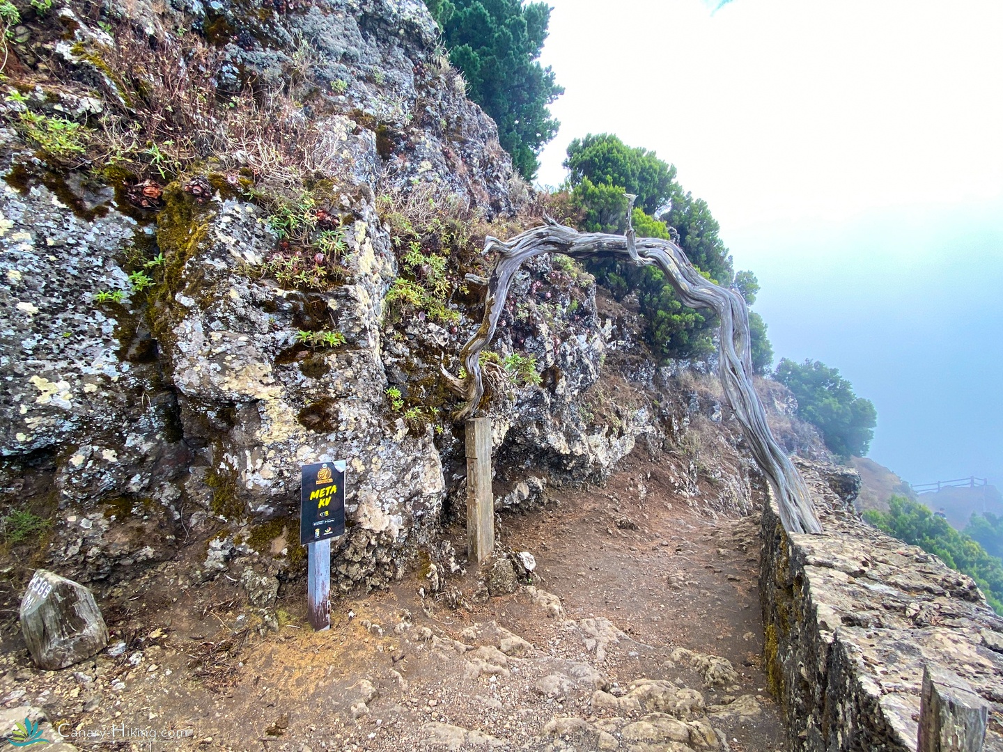
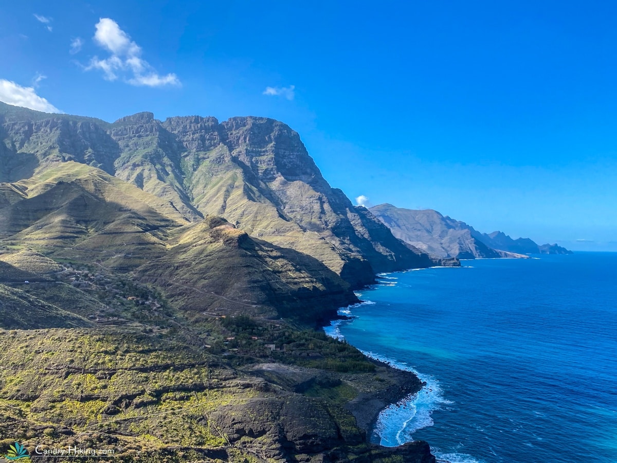
Your hiking adventure begins with a spectacular climb from the coastal town up into the mountains, passing through the breathtaking Tamadaba Natural Park. Declared a UNESCO Biosphere Reserve, this region is one of the wildest and most untouched on Gran Canaria.
The trail quickly climbs – the first 8 km take you up to 1200 meters. You’ll hike among ancient Canary pine forests, along dramatic cliffs, and through ravines full of life. The views of the rugged west coast are absolutely magical.
You’ll finish the day in Artenara – the highest village on the island – where many locals still live in traditional cave homes carved into the rock. Don’t miss the small chapel of Virgen de la Cuevita, also tucked into a cave and cherished by the locals.
Tonight, you’ll sleep in a place with panoramic views over the heart of Gran Canaria.
Distance: 20 km
Elevation gain/loss: +1660 m / –440 m
- Option to split this stage into two stages. The free day in Tejeda will be removed.
3 | Extra stage: Artenara to Tejeda – A Tasty Stop in Gran Canaria’s Heart
Today’s extra stage leads you from Artenara to the picturesque mountain village of Tejeda, one of the prettiest and most beloved spots on the island. The distance is modest, giving you time to enjoy the journey at your own pace.
Along the way, you’ll pass Cruz de Tejeda, a scenic mountain crossroads lined with local stalls selling crafts and treats – the perfect spot to rest, shop, or just soak in the views. The weather here can be surprising: cool and misty, or warm and sunny.
In Tejeda, you’ll be welcomed by a warm village atmosphere, with cozy restaurants, terraces, and shops. Make sure to try the famous local almond pastries – the sweet scent fills the streets!
Distance: 11 km
Elevation gain/loss: +570 m / –740 m
4 | Tejeda – Optional Hiking Day or Well-Deserved Rest
Welcome to Tejeda – one of the officially most beautiful towns in Spain. You’ll spend two nights here, giving you the chance to fully enjoy this gem in the mountains.
How you spend the day is up to you. Ready for more adventure? We provide you with a spectacular loop hike through the dramatic landscape surrounding the village.
Prefer to rest? Grab a sunny terrace seat, explore the narrow streets lined with whitewashed houses, or simply relax and enjoy the mountain peace.
Distance (optional hike): 10 km
Elevation gain/loss: +580 m / –580 m
5 | From Tejeda to San Bartolomé de Tirajana – To the Rooftop of the Trail
Today’s route leads you to the highest point of your trek. Soon after leaving Tejeda, you’ll once again pass Cruz de Tejeda – a great spot for a coffee and a break before continuing.
The trail then takes you along stunning mountain ridges, through peaceful countryside with grazing sheep, and gradually descends from 1700 to 900 meters. Expect dramatic views, silence, and a strong connection to nature throughout the day.
At the end of the hike, a welcoming Casa Rural in the center of San Bartolomé awaits. And if you’re an early riser – the village bakery opens early and serves some of the island’s best fresh bread and treats!
Distance: 20 km
Elevation gain/loss: +810 m / –990 m
6 | From San Bartolomé to Arteara or Ayagaures – Entering the South
Today, the trail gradually descends toward the sunny south of Gran Canaria. The scenery changes visibly: rugged highlands slowly give way to warmer, drier valleys dotted with palm trees.
From San Bartolomé, you’ll follow winding paths and ancient trade routes either to the tranquil village of Arteara – nestled in a palm valley – or to Ayagaures, a picturesque mountain hamlet overlooking a scenic reservoir.
The final destination depends on accommodation availability, but rest assured – both routes offer fantastic views and a peaceful end to the day.
Route 1 – Arteara: 10 km | +90 m / –630 m
Route 2 – Ayagaures: 17 km | +430 m / –1030 m
7 | Descent to the Coast – Final Destination: Maspalomas
The last stage of your journey leads you downhill through a striking barranco – a rugged canyon. As the mountains fade into the background, you’ll feel the warmth rise and the sea draw near.
Your journey ends at the iconic Maspalomas lighthouse, where nature meets vibrant coastal life. Enjoy your final night in a comfortable accommodation within walking distance of the beach. The perfect place to relax, refresh, and perhaps take a well-earned swim.
Distance: 18 km
Elevation gain/loss: +164 m / –458 m
Prefer to skip the extra hiking day?
No problem! Choose the 5-day hiking itinerary with one extra overnight stay in Maspalomas – a wonderful way to unwind by the sea after your trek.
You can select this option when booking. Please note: a small additional fee applies.
Departure Information
If you’ve booked the 8-day package, we’ll arrange your transfer to the airport. Want to extend your stay? Let us know – we’re happy to help with additional nights.
Including
- Travel time: 8 days
- Transfer airport to Accommodation
- Individual trek over 75 km
- Including Lugagetransfer
- Accommodations mostly with breakfast
- Hiking pin from Canary Hiking
- Travel guarantee STO
- Whatsapp support
Exclusive
- Outward and return journey
- Travel and cancellation insurance
- All meals and drinks except breakfast
- Booking costs
- Possible single room supplement € 295.00
- Transfers outside the program
- Luggage transport supplement for 1 person
Our special accommodations
Because we stay in charming, small-scale accommodations with an authentic character, the accommodations shown may differ from what you actually get. Don’t worry – we always provide an equal or even more special place to stay. Be surprised by the unique atmosphere of each location!


The hiking pin of the GR131
Our unique hiking pin. Each island has its own color. You get this hiking pin when you complete the GR131 Camino Naturales on one of the seven islands. With a group tour you get this at the end of the trip. With an individual trip you take a stamp ticket with you that you have signed off at different locations. With this card you will receive your earned hiking pin. You are eligible for this if the trip is booked with Canary Hiking!
Colors
Each island has its own color. Did you walk the 630 km and save all the colors together? Then you will receive a unique pin from us!

Distance
85 km
Difficulty
Medium
Up
3630 m.
Down
3640 m.
Frequently Asked Questions GR131 Gran Canaria
How difficult is the hike on Gran Canaria?
The GR131 on Gran Canaria is a medium to tough hike. You walk an average of 15 km per day with considerable differences in altitude on the first few days (up to +1300 m ascent). A good basic condition is therefore necessary. From the first day of hiking you walk up to the centre of Gran Canaria. Once you have reached the highest point? Then you descend to your final destination Maspalomas.
How long does the trip take?
The walking trip takes 8 days in total, including arrival and departure day. You walk for 5 days, with a rest day on day 3 that you can use as a walking day.
Is the route well marked?
Yes, the GR131 is now well marked on Gran Canaria. You will also receive a detailed script and GPX files.
Is luggage transport included?
Yes, your luggage is transported for you daily. You only walk with a light daypack and can enjoy the route without any worries.
What kind of accommodations can I expect?
You will stay in small-scale, characterful accommodations, ranging from rural casas to cozy guesthouses. Authentic, hospitable and far away from mass tourism. In Maspalomas there are mainly large resorts. We use a nice accommodation with a lovely swimming pool, about 2 km walking distance from the sea.
Can I also walk the route in the opposite direction?
In principle, the route is designed from northwest to southeast (Puerto de las Nieves to Maspalomas), because this is the most logical in terms of altitude and logistics. Deviation is possible in consultation.
What is the best time to travel?
The GR131 on Gran Canaria is good to walk all year round. Spring and autumn often offer the best conditions in terms of temperature and visibility. In summer, it can get very hot, especially in the south.
Can I book this trip alone?
Yes, the GR131 is very suitable for solo hikers. Everything is arranged for you and there are enough other hikers and locals along the way to make you feel safe.
Are walking poles recommended?
Definitely! Walking poles are highly recommended because of the steep descents and ascents. They provide more stability and less strain on knees and ankles.

🥾 Conquer the Canary Islands, Collect Unique Pins! 🏅
Trek the GR131 Camino Naturales and collect a special Canary Hiking pin for each completed island – each in a unique color to symbolize your achievement!
Group trip? Receive your colorful pin at the end of the tour.
Solo adventurer? Collect stamps on your card at each milestone and we will send your pin!