Trek GR131 Fuerteventura

 1.150,00

12 – Days Selfguided Trek including luggage transfer

Discount:
Departure:
  • Indicate your preferences

Total: 1150.00

Tour info

Duration:
12 Days, Selfguided Hike ***
Transport:
Transfers, luggagetransfer
Tour Type:
Individual Trekking
SKU:
Fuerte-P4-E
Group size:
1
Location:

Accompanied service

Yes, I request this trip without obligation. If you press the Book now button above, we will send you a travel proposal. You only pay when you have approved the travel proposal. Only then do we ask for a down payment of 20%. The remainder must be paid no later than 6 weeks before departure. If the trip starts within 6 weeks of booking, the full amount will be paid in one go. You pay to STO Garant so that your payment is safe until the end of the trip. Always read our travel conditions.

Special offer

Description

Niveau

GR131 Fuerteventura – Discover the Rugged Heart of the Canary Islands

After the adventurous start on Lanzarote, Fuerteventura is the second island on the legendary GR131 hiking trail. Spanning 160 kilometers, it’s also the longest section of the GR131 – a truly special journey for those who want to experience the raw and untouched side of Fuerteventura.

The GR131 Route: From Los Lobos to the Southern Tip of the Island
Your adventure begins with a magical detour to the protected islet of Isla de Lobos – a small natural paradise where peace and wild beauty reign. From there, you’ll hike south over the course of eight days, covering roughly 20 kilometers per day along mostly unpaved and peaceful trails.

Sandy Tones, Mountain Landscapes and Hidden Stories
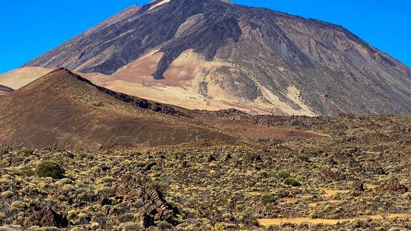
Fuerteventura is a world apart from Lanzarote. The island is gentle in tone, with sweeping sand plains, rolling hills, and enchanting bays. In the heart of the island, you’ll cross the impressive Betancuria mountain range – a place that makes you feel small amid towering peaks and deep, silent valleys. This is the oldest and most historically rich region of Fuerteventura.

Ending on the Sun-Drenched Southern Coast
The trail finishes on the southern coast, at the fishing village of Morro Jable. Along the way, you’ll barely encounter other hikers – a rare opportunity to be truly alone with nature. Your journey ends with sweeping views of turquoise waters and the island’s endless white beaches.

Freedom and Ease with Daily Luggage Transfers
Just like on Lanzarote, this route is designed for carefree hiking. Your luggage is transported for you each day, so you can focus fully on the solitude, the views, and the special atmosphere of the island.

Authentic Overnight Stays, Far from the Crowds
You’ll stay in charming, small-scale accommodations carefully selected for their character, comfort and warm hospitality. From rural cottages to friendly guesthouses – this is Fuerteventura as the locals know it.

The entire GR131 route across Fuerteventura takes twelve days to walk. With a highest point of only 807 metres, the walks are not particularly difficult technically. What makes this walk challenging is mainly the daily distance: you walk an average of 15 to 20 kilometres per day on unpaved paths. We give this walk *** stars in terms of difficulty, not because of steep climbs or technical passages, but because of the physical effort that the walk demands of you.

Wandelen GR131 Fuerteventura azuurblauwe zee
Wandelen GR131 Fuerteventura berglandschap
Wandelen GR131 Fuerteventura Morro Jable
  • Start on the tiny but magical island of Los Lobos
  • Cross the rugged and impressive Betancuria mountains
  • From north to south – 160 km of pure adventure
  • Hike through landscapes that feel like another planet
  • No crowds, just silence
  • White beaches and turquoise seas
  • Worry-free enjoyment – everything is arranged for you
  • Including luggage transfers

1 | Arrival in Corralejo 
Welcome to Fuerteventura! Your adventure begins! Depending on your preference (and the best flight connection), you’ll arrive on either Fuerteventura or the nearby Lanzarote. If you choose Lanzarote, a simple bus ride brings you to Playa Blanca in the south, where a short ferry trip will take you across the sea to Corralejo – the lively northern tip of Fuerteventura. Your comfortable accommodation awaits in Corralejo. Stroll through its charming streets, soak in the seaside atmosphere, or enjoy dinner with a view of the island of Los Lobos. The real hiking starts tomorrow, but tonight is for relaxing and arriving in the island spirit.

2 | Expedition to Los Lobos
8 Km of hidden beauty Today, your trek begins with a special mini-expedition: a boat ride to the small island of Los Lobos, a 6 km² nature reserve full of charm. The name – “wolf island” – refers to the monk seals that once lived here, known as “sea wolves.” You’ll land at a magical bay near Casas del Puertito, a sleepy hamlet with a few rugged stone houses and one simple beachside restaurant – perfect for a barefoot lunch in the sand.

Distance: 10 km
Elevation: +80 m / -80 m

3 | Corralejo to Villaverde 
Craters and sweeping views Today marks the true start of your Fuerteventura crossing – a longer stage, but a great warm-up. Leaving lively Corralejo behind, you’ll enter the quiet interior, passing ancient volcanic craters. As you climb, it’s worth turning around – behind you, a breathtaking panorama of Los Lobos and Lanzarote unfolds. Halfway through, take a well-earned break in the peaceful village of Lajares, where you can enjoy a terrace or simply rest your feet. You’ll continue on to Villaverde, today’s destination – a friendly village in gently rolling hills.

Distance: 22 km
Elevation: +440 m / -230 m

4 | Villaverde to Tefia 
A warm welcome in the island’s heart After yesterday’s hike, today’s stage is shorter and more relaxed, taking you towards Tefia. Along the way, you’ll pass through the quiet village of Tindaya, nestled at the base of a nearly 400-meter sacred volcano. The day ends on an ochre-colored plain, where the landscape feels almost surreal. Welcome to Tefia, a charming village where your accommodation – a traditional casa rural – feels like a step back in time. Run by the warm and welcoming Carla, this place is a true refuge. Choose between a smaller room with private bathroom, or a larger room with shared facilities and a handy washing machine.

Distance: 24 km
Elevation: +220 m / -290 m

5 | Tefia to Betancuria 
Kings, panoramas, and the island’s past A varied and scenic day awaits! After a gentle start through Valle de Santa Inés, the trail climbs higher into the hills. Suddenly, you’ll find yourself face-to-face with the Estatuas de Guise y Ayose – two striking bronze statues (4.5 meters tall) of the legendary Guanche kings. From this panoramic viewpoint, you can look back at the route you’ve walked. On a clear day, you may spot Los Lobos and even Lanzarote on the horizon. Then begins the descent to Betancuria, the former capital of Fuerteventura, nestled in a lush valley surrounded by hills – a village steeped in history.

Distance: 15,6 km
Elevation: +490 m / -240 m

6 | Betancuria to Pájara 
Solitude and soaring silence Leaving Betancuria, the trail ascends steeply – challenging but rewarding. At the top, you’ll enjoy expansive views over the valley below. The landscape here is wild and quiet. Only the sound of the wind and birds of prey breaks the silence – a deeply serene experience. About halfway, a surprisingly atmospheric restaurant appears, ideal for a break and to refill your water supply. After the second tough climb, you descend into Pájara, a peaceful village where today’s effort ends. A challenging but unforgettable day.

Distance: 16,8 km
Elevation: +470 m / -650 m

7 | Pájara to La Pared 
The queen stage of the trail Prepare for what might be the most demanding – and breathtaking – stage of the trek. Leaving tranquil Pájara, you’ll head straight into the island’s most dramatic terrain. This is Fuerteventura in its rawest form – nature takes center stage here. The silence is overwhelming. No traffic, no voices, just the wind and your footsteps. And those views! Climb higher and you’ll be rewarded with stunning sights of both the east and west coasts. On clear days, you might even spot Tenerife’s Teide volcano on the horizon. A long descent opens up views of the wild west coast and the day’s endpoint – La Pared, a small seaside village where the sun sets into the Atlantic.

Distance: 25,5 km
Elevation: +540 m / -710 m

8 | La Pared to Costa Calma
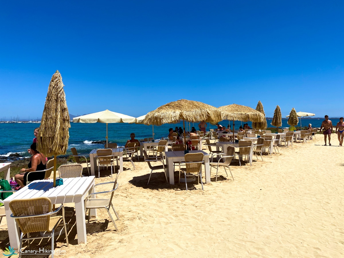
Rugged to relaxed An early start today, but no worries – this is a shorter stage, made special by the dramatic landscape shift. Leaving La Pared, the rugged mountains fade into open sandy terrain with vast views. You’re now at the narrowest part of Fuerteventura, and in just a few kilometers, you’ll cross from west to east. On the horizon lies Costa Calma, a laid-back beach town known for its long sandy shores and constant trade winds – making it a hotspot for surfers and kiteboarders.

Distance: 11,5 km
Elevation: +200 m / -200 m

9 | Free day in Costa Calma 
Sand, sun and serenity Time to give your hiking boots a break. Costa Calma lives up to its name – a peaceful coastal town perfect for relaxation. Whether you’re a sun-seeker or still feeling active, there’s something for everyone. Lounge by the pool, explore the endless beach, or take a refreshing swim in the sea.

10 | Costa Calma to Morro Jable 
From barefoot paths to fishing vibes The final stages of your adventure follow Fuerteventura’s stunning coastline. Today’s path leads mostly along wide sandy beaches, with the ocean by your side. The sea breeze, soft sand and endless horizon create a calming rhythm. You’ll arrive in Morro Jable, a seaside town that still retains its fishing village charm, despite neighboring touristy Jandía. Picture narrow streets, bobbing fishing boats, and cozy tapas bars by the water.

Distance: 22 km
Elevation: +150 m / -180 m

11 | Morro Jable to Punta de Jandía 
The ultimate finish This is it – your final, and perhaps most iconic stage. You’ll head south along a rugged, rolling path toward Fuerteventura’s southernmost point – the lighthouse at Punta de Jandía. Though you’ll see the lighthouse from afar, don’t be fooled – the sun is intense and the path is long. Just before reaching the end, you’ll pass the sleepy fishing hamlet of Puertito – with only twenty residents and one sandy-footed restaurant, it feels like time stands still. After a well-deserved break and a cold drink, a 4×4 bus returns you to Morro Jable – make sure not to miss the last ride around 4 PM!

Distance: 22,2 km
Elevation: +200 m / -200 m

12 | Departure
Head and heart full of memories Your Fuerteventura trek comes to an end. After one last breakfast, you’ll be picked up and transferred to the airport. As you drive past familiar landscapes, memories will naturally float back. You leave the island perhaps a little wistful, but mostly filled with stories and the deep calm of nature.

Ready for your next island? Gran Canaria awaits!

Inclusive

  • Travel time: 12 days
  • Transfer airport
  • Including Luggage transfers
  • Individual trek over 160km
  • Crossing Los Lobos
  • Accommodations mostly with breakfast
  • Hiking pin from Canary Hiking
  • Travel guarantee STO
  • Whatsapp support

Exclusive

  • Outward and return journey
  • Travel and cancellation insurance
  • All meals and drinks except breakfast
  • Booking costs
  • Possible single room supplement
  • Transfers outside the program

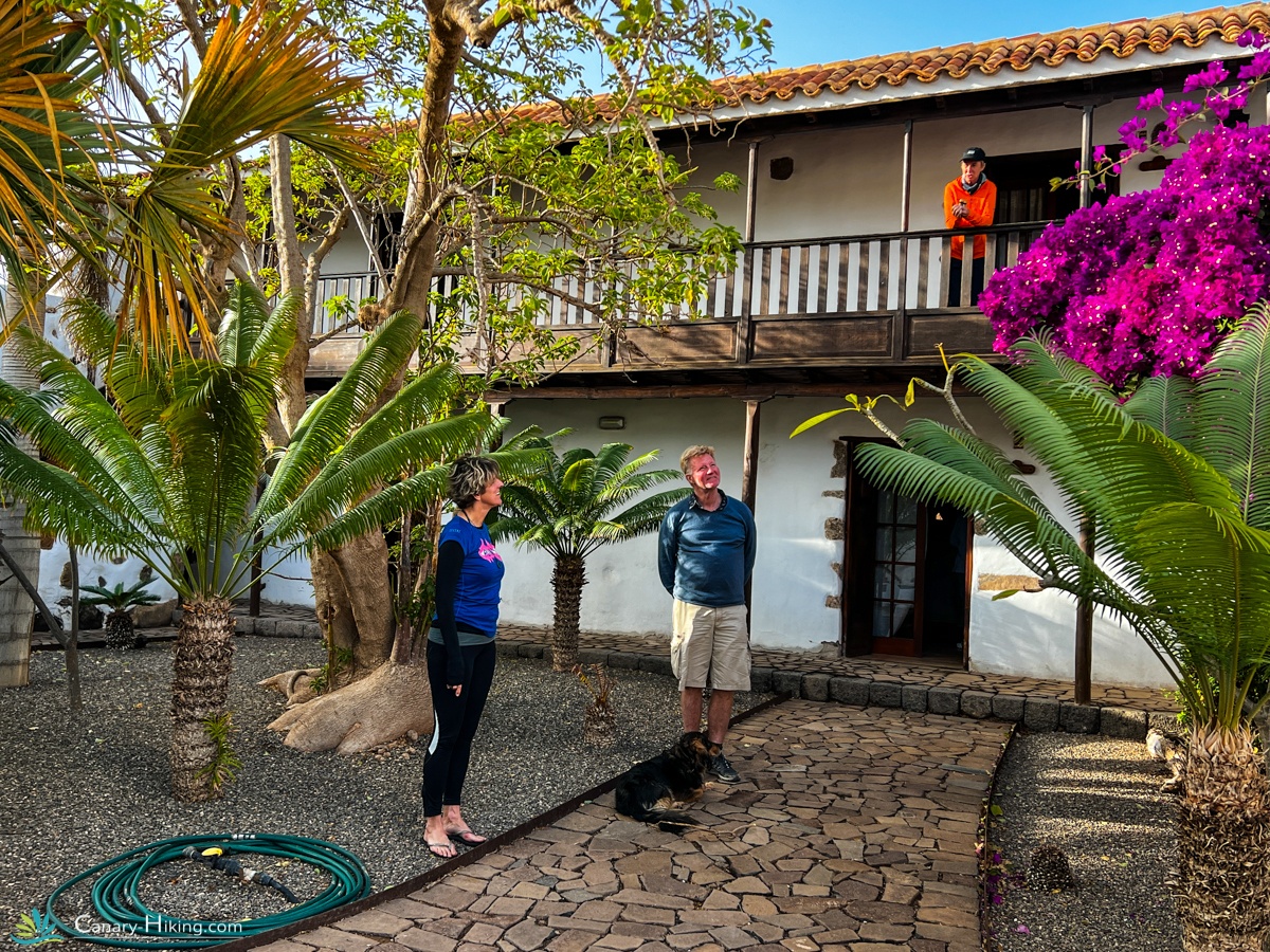
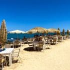
Some of our special Accommodations

GR131 wandelpinnen van Canary Hiking

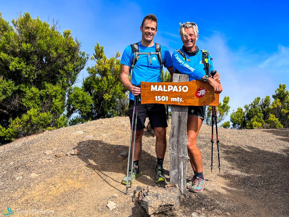
The hiking pin of the GR131

Our unique hiking pin. Each island has its own color. You get this hiking pin when you complete the GR131 Camino Naturales on one of the seven islands. With a group tour you get this at the end of the trip. With an individual trip you take a stamp ticket with you that you have signed off at different locations. With this card you will receive your earned hiking pin. You are eligible for this if the trip is booked with Canary Hiking!

Colors

Each island has its own color. Did you walk the 630 km and save all the colors together? Then you will receive a unique pin from us!

GR131 Fuerteventura
Distance

160 km

Difficulty

Medium

Up

3073 m.

Down

3078 m.

Frequently Asked Questions – GR131 Fuerteventura

How difficult is the GR131 trail on Fuerteventura?

The route is not technically difficult – there are no steep climbs or exposed paths. The highest point on the island is only 807 meters. However, the daily distances of 15–20 kilometers over dry, sometimes windy terrain can be physically demanding. That’s why we rate this trek as 3 out of 5 stars in difficulty.

How many days does the full GR131 Fuerteventura route take?

This version of the trail takes 12 days in total, including arrival, departure, and one or two shorter hiking days for rest and discovery. The walking itself is spread over 8 full hiking days.

What kind of landscapes can I expect?

Fuerteventura is known for its surreal beauty. Expect endless beige and ochre hills, wide open plains, volcanic ridges, remote valleys, and coastal stretches with turquoise sea views. The scenery constantly shifts, making every day unique.

Will I meet other hikers along the way?

Most of the time, you’ll walk in peaceful solitude. Fuerteventura is one of the quieter islands on the GR131, so it’s perfect for those looking to disconnect and experience nature without crowds.

Is baggage transport included?

Yes. Your luggage will be transported for you each day, so you only need to carry a daypack with water, snacks, and essentials. You can choose to carry the luggage with you.

What kind of accommodations can I expect?

We select small-scale, authentic lodgings, often run by locals – from rural casas and small hotels to guesthouses in sleepy villages. Don’t expect luxury, but do expect charm and warm hospitality.
In Morro Jable there are mainly large resorts. We use a simple smaller hotel with a swimming pool, but without breakfast. If you want to stay in a luxury hotel, please contact us. We can book a nice big hotel for you for an additional fee.

What should I bring?

Good walking shoes, sun protection, a refillable water bottle, and light clothing for warm, dry conditions. A windbreaker is also useful, especially on higher ground.

When is the best time to do this trek?

Fuerteventura is walkable year-round, but the best months are October to April, when temperatures are milder and the sun is less intense.

Can I book this trip solo?

Absolutely! This tour is designed for individual hikers who want freedom and adventure, without worrying about logistics.

What happens at the end of the trek?

Your journey ends in Morro Jable, on the sunny south coast. After a final overnight stay, a transfer will bring you back to the airport or your next destination.

Additional information

Programma

Het programma

1, Aankomst in Corralejo

Vliegen kan (afhankelijk je voorkeur en de vluchtprijs) op Fuerteventura en op Lanzarote. Vlieg je op Lanzarote dan reis je vanaf het vliegveld met de bus naar Playa Blanca in het uiterste zuiden. Vanaf hier neem je de veerboot naar Corralejo op het noordpuntje van Fuerteventura. Je wordt opgewacht bij de haven om naar de accommodatie te worden vervoerd. Vlieg je rechtstreeks op Fuerteventura dan staan we klaar op het vliegveld om je naar de accommodatie in Corralejo te brengen; een exclusief landhuis ‘Casa los países bajos’ waar we twee dagen zullen verblijven.

Onder het genot van een drankje maken we kennis met de groep. Je krijgt hier je goodybag en ‘s avonds geniet je van de gezellige sfeer van Corralejo, met volop restaurantjes en gezellige winkeltjes. Het wordt aanbevolen om hier alvast wat eten en drinken in te slaan voor de dag van morgen.

Vanaf de boulevard of een van de vele terrasjes, heb je een prachtig uitzicht op het naastgelegen eiland Los Lobos, alwaar morgen de eerste etappe van onze wandeling zal starten.

2, Vertrek naar Los Lobos – 8km

Na een nachtje rust en het ontbijt gaan we op weg. We vertrekken per boot voor de eerste etappe van de wandeling naar het eiland Los Lobos.
Het 6 vierkante kilometer grote “wolveneiland” dankt zijn naam aan de vele monniksrobben (in de volksmond zeewolven genoemd) die hier in het verleden in grote getale te vinden waren. Eind 19e eeuw werd het laatste dier gedood. Momenteel is het gehele eiland een beschermd natuurpark en worden bezoekers nog slechts beperkt toegelaten.

We komen met een bootje aan in een prachtig mooie baai bij de “Casas del Puertito”. Niet meer dan een gehucht met enkele stenen huizen en een bescheiden restaurantje. Wie hier wil aanschuiven voor het dagmenu kan het best bij aankomst gelijk reserveren.
Hier begint de wandeling van 8 kilometer richting noorden. Aan de noordkaap van het eiland biedt het uitkijkplateau van de vuurtoren een prachtig uitzicht op drie eilanden: Los Lobos, Lanzarote en Fuerteventura. Ook heb je vanuit hier mooi zicht op de 127 meter hoge vulkaan “Montaña de Lobos”. Het westelijke deel van de krater is in zee verzonken.

Na de wandeling is er tijd voor eten en drinken in het restaurantje of bijvoorbeeld aan de “Playa de Concha”. Een halfcirkelvormige baai met licht (haast Caribisch wit) zand, beschut tegen wind en branding. Een heerlijk plekje om uit te rusten van de eerste etappe van onze wandelvakantie!

Daarna varen we weer terug naar Corralejo.

3, Vertrek Corralejo naar La Oliva – 25km

Na de bescheiden etappe van gisteren, begint vandaag het serieuze werk. De route van vandaag is lang, maar niet erg moeilijk. We vertrekken richting zuiden en passeren enkele vulkaankraters. Wanneer we op enige hoogte terugkijken richting Corralejo, hebben we een prachtig uitzicht op Lanzarote en Los Lobos. We passeren het dorpje Lajares en nemen daar een kleine pauze. Deze eerste etappe is redelijk vlak, maar de zanderige ondergrond maakt het lopen best zwaar. Je zult al snel merken dat bescherming tegen de zon en voldoende drinkwater noodzakelijk is tijdens deze wandelvakantie.

Onze bestemming van vandaag is La Oliva, een plaats met historie. Van 1708 tot 1859 was hier de zetel van de legerleiding, waarvan het “Casa de los Coroneles” nog een historische getuige is. Het imposante gebouw werd enkele jaren geleden gerestaureerd en kan bezocht worden. Ook de kalkwitte parochiekerk met een klokkentoren van zwarte lavasteen is de moeite waard. Deze toren diende in vroeger tijden als wachttoren om de bewoners te waarschuwen voor aanvallen van piraten. Van 1834 tot 1860 was La Oliva de hoofdstad van Fuerteventura.

Na aankomst kunnen we lekker uitrusten bij de accommodatie of het dorpje bezoeken. Er zijn terrasjes en een kleine supermarkt aanwezig voor de nodige versnaperingen.

4, La Oliva naar Tefia – 18 km

Na de lange tocht van gisteren gaan we na het ontbijt op pad voor deze relatief korte etappe richting Tefia. De stilte van het eiland en niemand tegenkomen zal al opgevallen zijn. Weg van het toerisme en helemaal in de natuur van het eiland.

We komen door het dorpje Tindaya dat aan de voet ligt van een bijna 400 meter hoge vulkaan. Voor de Oudcanariërs was deze berg heilig. Ook nu zijn er nog veel legenden, maar de berg is beschermd en slechts beperkt te bezoeken. We houden pauze in een lokaal barretje en vervolgen onze weg richting zuiden. Een kilometer ten zuiden van Tindaya komen we nog langs de ” Montaña Quemada” (letterlijk: de verbrande berg), ook een met sagen omweven vulkaan. Het eindpunt van de etappe van vandaag is het dorpje Tefia, gelegen op een okerkleurige vlakte. Hier is slechts een lokaal restaurant en verder geen voorzieningen. Hier zullen wij voor een boodschappenservice zorgen.

We overnachten in een landelijke accommodatie vol rust en sfeer waar je onder het genot van een heerlijk avondmaal getuige zult zijn van een fantastische zonsondergang.

5, Tefia naar Betancuria – 19 km

Vandaag begint het klimwerk. Onderweg kunnen we voor een versnapering of proviand terecht in een van de pittoreske dorpjes die we tegenkomen. Na Valle de Santa Inés gaan we echt stijl omhoog. Boven komen we aan bij een uitkijkpunt met twee reusachtige beelden, de “Estatuas de Guise y Ayose”. De bronzen beelden van 4,5 meter hoog verbeelden de twee Guanche koningen Guise en Ayose, heersers uit het verre verleden van Fuerteventura. Het eiland dat toen nog Herbania genoemd werd, was verdeeld in twee rijken Maxorata in het noorden en Jandia in het zuiden. Vanaf hier hebben we een imposant uitzicht over het noordoosten van het eiland, waar we vandaan zijn gekomen. Bij helder weer zijn zelfs Los Lobos en Lanzarote waar te nemen aan de horizon.

Wanneer we aan de andere zijde de ” Montaña Tegú” afdalen, zien we in een lieflijke groene vallei de witte bebouwing liggen van Betancuria. Deze mooie plaats dankt zijn naam aan de conquistador Béthencourt, die hier in 1405 de eerste steen voor de eerste hoofdstad van het eiland legde. De streek was vruchtbaar en dankzij de ligging ten opzichte van de kust relatief veilig voor aanvallen van piraten. Pas in 1834 moest Betancuria de rang van hoofdstad afstaan aan La Oliva. Statige witte panden met sierlijke houten balkons en de vestingachtige “Catedral de Santa Maria” herinneren aan de vroegere tijden van welvaart.

Wanneer we uitgerust zijn en eventueel nog wat inkopen hebben gedaan, gaan we naar de oudste accommodatie van deze tocht die volop historie herbergt.

6, Betancuria naar Pájara – 17km

Vandaag een pittig dagje met flinke beklimmingen, maar met grandioze uitzichten. We verlaten Betancuria en wandelen al meteen naar het hoogste punt van de dag. We komen door valleien waar de stilte overheerst. Het enige geluid dat je hoort zijn de roofvogels die over de valleien vliegen. Een stukje natuur dat je nooit meer vergeet van dit eiland. De beklimmingen maken dit een zware tocht. We pauzeren bij een uit het niets opdoemende sfeervolle locatie, om zo naar de volgende zware beklimming te kijken. Zorg dat je hier je voorraad water aanvult.

Na de pauze vervolgen we ons pad om verder te klimmen. Eenmaal boven hebben we bijzondere en spectaculaire uitzichten over het Betancuria gebergte. Na ongeveer 7 kilometer dalen, bereiken we onze eindbestemming van vandaag: Pájara. Het historische centrum van Pájara met oude laurierbomen op de plaza is erg sfeervol. De tweebeukige parochiekerk “Nuestra Señora de la Regla” werd eind 17e eeuw gebouwd en is enigszins mysterieus. De ingang van de kerk is versierd met Azteekse ornamenten: zonnen, slangen en poema’s. Symbolen die volstrekt niet in het christelijke beeldenwereld passen.

In Pájara zijn een supermarkt en wat restaurantjes aanwezig. In onze accommodatie word je in de ochtend verrast door een uitgebreid ontbijt.

7, Pájara naar La Pared – 26 km

Vandaag zal opnieuw een erg zware dag worden, wellicht de zwaarste etappe. We vertrekken vanuit Pájara en zien het gebergte al snel voor ons opdoemen. Dit is het mooiste gebied van Fuerteventura. Je voelt je hier één met de natuur. De stilte doet soms pijn aan je oren, maar met één woord: prachtig! Adembenemende uitzichten naar beide kusten van het eiland staan je te wachten. Bij helder weer is aan de westelijke horizon zelfs de top van de Teíde op het buureiland Tenerife te zien!

Na een laatste loodzware klim dalen we met een prachtig zicht op de westkust geleidelijk af richting La Pared, de eindbestemming van vandaag. La Pared betekent letterlijk vertaald uit het Spaans “de muur”. Volgens een legende zou op deze landengte een verdedigingsmuur het noordelijke en zuidelijke rijk van Guise en Ayose van elkaar gescheiden hebben.

Hier verblijven we in een luxe hotel met heerlijke bedden en een zwembad. Voor degenen die nog niet moe genoeg zijn, zijn er sportfaciliteiten. Bij het hotel is een supermarkt aanwezig. De mogelijkheid om hier in de avond te eten is aanwezig. Een gigantisch ontbijtbuffet is inbegrepen.

8, La Pared naar Costa Calma – 7 km

Vandaag vertrekken we vroeg naar Costa Calma. Meteen ten zuiden van La Pared verandert het landschap opvallend. De bergen achter ons gelaten, lopen we nu door een soort van glooiend woestijnlandschap. In vergelijking met de afgelopen dagen een behoorlijk vlakke tocht.

Op het smalste stuk van het eiland steken we over naar de oostkust richting Costa Calma. Bij de surfers een geliefde plek vanwege de gunstige wind die hier het hele jaar door waait. Precies de reden waarom dit een van de meest beroemde surfstranden van Europa is. Na de korte wandeling van vandaag is het tijd voor rust en ontspanning.

9, Vrije dag Costa Calma

Costa Calma is een gezellig niet al te groot toeristenoord. De zonaanbidder kan lekker relaxen aan het zwembad of aan zee. Wie in beweging wil blijven kan zich uitleven aan het kilometerslange zandstrand. In de avond is er volop keuze aan restaurants en barretjes.

10, Costa Calma naar Morro Jable – 20 km

De laatste twee dagen van de wandelroute lopen we in zuidelijke richting merendeels langs het strand. Vandaag lopen we tot aan Morro Jable, waar we de komende twee nachten zullen verblijven.

Morro Jable heeft nog steeds de sfeer van een voormalig vissersdorpje, maar het is inmiddels versmolten met het ernaast gelegen erg toeristische Jandia. Hier kan volop gewinkeld worden. Je struikelt er over de souvenirwinkeltjes en terrasjes. De promenade in het oude Morro Jable is echter zeer sfeervol en een tafeltje direct aan het water is met enig geluk en geduld altijd wel te vinden. We logeren in een leuke accommodatie met zwembad.

11, Morro Jable naar Punto de Jandia – 21 km

Vandaag staat de laatste etappe van onze wandeling op het programma. Een tocht naar het uiterste zuidpuntje van Fuerteventura: de vuurtoren op “Punto de Jandia”. Toch nog veel op en af, waardoor deze tocht best zwaar is. Je ziet de vuurtoren al van ver liggen, waardoor het lijkt of je er bijna bent, maar schijn bedriegt. De weg voert steeds langs de kust.

Het enige kleine dorpje wat we tegenkomen heet “Puertito”, letterlijk vertaald “haventje”. Meer is het ook niet, het piepkleine gehuchtje met amper 20 inwoners ligt op ongeveer één kilometer van het eindpunt. Nadat we met de groep het eindpunt bereikt hebben en de nodige foto’s gemaakt hebben, keren we terug in het kleine dorpje om heerlijk bij te komen in het bescheiden restaurantje.

Hier worden we met een busje opgehaald en over een eindeloze onverharde weg weer teruggebracht naar Morro Jable. Mooi als we ‘s avonds ter afsluiting, onder het genot van een drankje, kunnen terugblikken op een onvergetelijke wandeltocht!

Informatie over de terugreis

Mocht je een 12-daagse reis geboekt hebben, dan word je keurig naar het vliegveld van Fuerteventura of naar de haven van Corralejo gebracht.

Voor wie op eigen gelegenheid langer wil blijven, is er vanuit Morro Jable een busverbinding of taxi beschikbaar naar diverse bestemmingen. Of je huurt een auto.

Transfers

Vliegveld, Bagage, naar de accommodatie wanneer het nodig is.

Inclusief

Reisduur: 12 dagen / 11 nachten
Transfer luchthaven
Georganiseerde hikingtocht over 160km
Overtocht Los Lobos
Accommodaties met ontbijt
Bagagevervoer
Buff en RVS drinkfles
Reisgarantie STO

Exclusief

Heen- en terugreis
Reis- en annuleringsverzekering
Alle maaltijden buiten het ontbijt
€20,00 boekingskosten
Eventuele éénpersoons kamertoeslag (€195,00)

Voordelen

Avontuurlijk
Uitdagend
Actief
Intensief ervaren
Veel vrijheid
Kleinschalig
Authentiek
Weg van de massa
Wij ondersteunen lokale ondernemers

You may also like…

  • Gran Canaria

    8 Days Trek Camino Natural GR131 Gran Canaria

     995,00
    8 Days, Trekking **** Transfer, Lugagetransfers
  • Tenerife

    8 Days hikingtrip Camino Naturales GR131 Tenerife

     995,00
    8 days, Hiking Transfer, Lugagetransfers
  • La Gomera

    8 Day Trek GR131 La Gomera

     975,00
    8 Days, Trekking **** Transfer, Lugagetransfers, Ferry, Incl. Guide
  • Lanzarote

    8 Day Trek GR131 Lanzarote

     975,00
    8 Days, Hiking Transfer, Lugagetransfers