Description
Difficulty Level


Gran Canaria Panorama Trail: Hiking from the North to the Southeast
The Gran Canaria Panorama Trail is an 8-day hiking holiday that allows you to actively discover the island. You hike from village to village and also complete three beautiful circular walks from your accommodations. The route takes you from the green north, through the mountainous interior, to the sunny southeast of Gran Canaria.
Along the way, you stay in atmospheric and authentic places such as Firgas, Teror, Cruz de Tejeda and Agüimes. You hike through forests and valleys, along historic connecting paths and through the mountainous heart of the island.
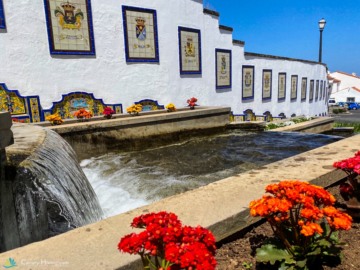
The journey begins in Arucas, a characteristic town in the north of Gran Canaria. From here, you continue to Firgas and Teror, known for their traditional Canarian architecture, charming squares and historic streets.
From Teror, you hike the Alamo Trail, a varied circular route through the green interior of the island. You then continue climbing towards Cruz de Tejeda, one of Gran Canaria’s main hiking hubs. Here you stay for two nights, giving you the opportunity to hike to the mountain village of Tejeda.
The final stage takes you towards Agüimes in the southeast. Along the way, the landscape gradually changes from green and mountainous to drier and warmer. A beautiful way to finish this hiking holiday across Gran Canaria.
What makes the Gran Canaria Panorama Trail special?
✅ Green north: discover the landscapes around Arucas, Firgas and Teror, with forests, valleys and traditional villages.
✅ Authentic villages: stay in characteristic places and discover a less touristy side of Gran Canaria.
✅ Cruz de Tejeda: stay in the heart of the mountain region and explore the central part of the island from here.
✅ Trekking and circular walks: three hiking days take you to a new accommodation, while three additional days feature circular walks starting from your accommodation.
✅ From north to southeast: experience several very different landscapes of Gran Canaria within one hiking holiday.
✅ Luggage transfer: your luggage is transported between accommodations, so you can hike with only a light daypack.
Hiking level
The elevation changes are noticeable on several days, but the daily distances remain relatively moderate. With an average of around 10 to 17 kilometres per day, this hiking holiday is less demanding than the GR131 on Gran Canaria.
A normal level of fitness is sufficient, although some experience with hiking in hilly or mountainous terrain is recommended.
Included in this hiking holiday
✓ 8-day individual hiking holiday
✓ Accommodation in carefully selected places
✓ Luggage transfer between accommodations
✓ All necessary transfers during the hiking holiday
✓ Detailed Canary-Hiking itinerary with practical information
✓ Access to the Canary-Hiking Travel App with daily programmes, routes, GPX files and accommodation information
✓ 1 month of free access to the Canary-Hiking Travel App from the start of your trip
- Historic village of Firgas
- Walk the Alamo Trail near Teror
- Stay in authentic casas rurales
- Reach Cruz de Tejeda
- Discover the peaceful Barranco de Guayadeque
- Visit the mountain village Tejeda
- Flexible itinerary
- Daily luggage transport included
- Roque Nublo

Day 1 | Arrival on Gran Canaria
Upon arrival on Gran Canaria, you will be picked up by taxi at the airport and transferred to the north of the island. You will spend the first two nights in Arucas, where the route begins in the green northern part of Gran Canaria.
Day 2 | Circular hike Arucas – Firgas
Today you start your first walking day with a varied circular hike between Arucas and Firgas. You leave Arucas heading towards the countryside, passing the well-known Arehucas rum distillery before following quiet paths into a more rural landscape.
Distance: 14 km
Elevation: +460 m / –460 m
Day 3 | From Arucas to Teror
Today you follow the Barranco de la Virgen southwards, hiking through a varied landscape of valleys and farmland towards the hilltop town of Teror. Known for its wooden balconies, cobbled streets and Sunday market, Teror is one of the island’s most atmospheric historic villages. You’ll stay in a centrally located apartment in or near the old town.
Distance: 16 km
Elevation: +690 m / –590 m
Day 4 | Circular hike – Alamo Trail
Today’s route is the Alamo Trail, a peaceful walk through the rural countryside around Teror. You follow old connection paths through small fields, shaded woodland and rural hamlets. Parts of the trail include stone stairways, originally built by local farmers to navigate the steeper slopes.
After leaving the village via a narrow path, you descend into the valley. The route takes you past El Álamo, a tiny settlement where time seems to stand still. You continue into a narrow ravine, cross a small stream, and begin a steady climb back up. Along the way, enjoy wide panoramic views of the lush and varied landscape around Teror.
Distance: 6 km
Elevation: +240 m / –250 m
Day 5 | From Teror to Cruz de Tejeda
You leave Teror and hike into the island’s mountainous interior. This stage climbs steadily through valleys and pine forest towards Cruz de Tejeda, a key crossroads for Gran Canaria’s hiking trails. Though the distance is moderate, this day includes the highest ascent of the entire route.
As you gain height, the landscape shifts from green farmland to open pine forest and finally to rocky ridgelines. At 1,500 metres, you arrive in Cruz de Tejeda, literally the heart of the island. The village is marked by a stone cross that served as a landmark for shepherds and pilgrims for centuries.
You stay two nights at the Parador, a comfortable mountain hotel with stunning views. The surrounding square has small local stalls and cafés — a peaceful place to relax between walks.
Distance: 11.5 km
Elevation: +1090 m / –170 m
Day 6 | Rest day or optional hike to Tejeda
Today you can choose: take a day off to relax in Cruz de Tejeda, or hike to the picturesque village of Tejeda — officially one of Spain’s most beautiful villages.
The trail descends along an old path with views of Roque Nublo and Roque Bentayga. Tejeda lies on a plateau surrounded by dramatic mountain scenery, with whitewashed houses and artisan bakeries. Try some local sweets like almond cakes or handmade ice cream before hiking back up. You can also take a taxi for the return.
Distance: 14 km
Elevation: +800 m / –800 m
Day 7 | Barranco de Guayadeque to Agüimes
The final hike of your Panorama Trail starts high in the central mountains and descends into the Barranco de Guayadeque, one of Gran Canaria’s longest and greenest ravines. After a short transfer, you begin your descent towards the island’s southeast.
As you drop below the cloud line, the vegetation changes from highland forest to cactus and palm-filled valleys. The trail winds between dramatic cliffs, cave dwellings, and archaeological sites. Guayadeque is not only scenic but also rich in culture and history.
You finish in Agüimes, a colourful and welcoming village with pastel houses and a charming main square. It’s the perfect place to relax and celebrate the end of your journey.
Distance: 14 km
Elevation: +20 m / –1280 m
Day 8 | Departure or extension
If you’ve booked the 8-day tour, you’ll be transferred back to the airport today.
Prefer to extend your stay? Let us know — we’re happy to help you plan extra nights or activities.
Inclusive
- Trip Duration: 8 days
- Airport Transfers: Roundtrip transfer from the airport to your accommodation
- Self-Guided Hike: 68km point-to-point trek
- Luggage Transport: Your bags are transferred between accommodations
- Charming Stays: Overnight in cozy casas rurales with private room & bathroom
- Meals: Most accommodations include breakfast
- Travel Guarantee: Secured via STO Garant
- Support: WhatsApp assistance throughout your journey
- Navigation: GPX tracks + detailed route descriptions provided
- Acces to our travel app
Exclusive
- Travel to and from Gran Canaria
- Travel and cancellation insurance
- All meals and drinks not mentioned in the program
- Booking fee
- Possible single room supplement
- Possible luggage supplement for solo travelers
- Any transfers not included in the standard program


Distance
68 km
Difficulty
Gemiddeld
Up
3180 m.
Down
3430 m.
Frequently Asked Questions Panorama Trail Gran Canaria
How difficult is the hike in Gran Canaria?
The Panorama Trail on Gran Canaria is a moderately difficult to challenging hike. You’ll hike an average of 10-15 km per day with elevation gain and loss. A good basic level of fitness is therefore essential. From the first day of hiking, you’ll ascend to the center of Gran Canaria, Cruz de Tejeda, over a few days, where you’ll descend via a scenic ravine to Aguïmes.
How long does the journey take?
The hiking tour lasts 8 days in total, including arrival and departure. You’ll hike for 6 days, with 3 circular walks that you can use for a rest day.
Is the route well marked?
The route is well marked, but to follow our journey completely, we recommend following the GPX files.
Is luggage transport included?
Yes, your luggage will be transported for you daily. You’ll only need a light daypack and can enjoy the route without any worries.
What kind of accommodations can I expect?
You’ll stay in small, charming accommodations, ranging from rural casas to cozy hotels. During the trek, you’ll spend two nights at the Parador hotel. Authentic, welcoming, and far removed from mass tourism.
Can I also walk the route in the opposite direction?
The route is generally designed from north to southeast (Firgas to Aguïmes), as this makes the most sense in terms of elevation gain and logistics. Deviations are possible upon consultation.
What is the best time to travel?
The GR131 on Gran Canaria is easy to walk year-round. Spring and autumn often offer the best temperature and visibility conditions. Summers can get very hot, especially in the south.
Can I also book this trip alone?
Yes, the trail is perfectly suited for solo hikers. Everything is arranged for you, and there are plenty of other hikers and locals along the way, ensuring a sense of security.
Are walking sticks recommended?
Absolutely! Hiking poles are highly recommended because of the steep descents and ascents. They provide more stability and less strain on your knees and ankles.